Category:De Beauvoir Town
Jump to navigation
Jump to search
area of Hackney, East London | |||||
| Upload media | |||||
| Instance of | |||||
|---|---|---|---|---|---|
| Location |
| ||||
 | |||||
English: De Beauvoir Town is a district of the London Borough of Hackney. Its borders are Kingsland Road in the east, Southgate Road to the west, the Regent's Canal in the south and Ball's Pond Road to the north.
Subcategories
This category has the following 6 subcategories, out of 6 total.
Media in category "De Beauvoir Town"
The following 72 files are in this category, out of 72 total.
-
 29 Branch Place - geograph.org.uk - 6218998.jpg 1,024 × 678; 598 KB
-
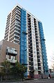
 Acton Apartments - geograph.org.uk - 6218992.jpg 678 × 1,024; 780 KB
-
 Avebury Court - geograph.org.uk - 6218991.jpg 678 × 1,024; 710 KB
-
 Balls Pond Road at the junction of Southgate Road - geograph.org.uk - 6335563.jpg 1,920 × 1,280; 1.06 MB
-
 Blandford Court, Dalston - geograph.org.uk - 6301759.jpg 1,920 × 1,280; 888 KB
-
 Blandford Court, Dalston - geograph.org.uk - 6301797.jpg 1,920 × 1,280; 1.29 MB
-
 Building site by Whitmore Bridge, Regent's Canal - geograph.org.uk - 5832017.jpg 1,024 × 768; 312 KB
-
 Cable warning - geograph.org.uk - 6219009.jpg 1,024 × 523; 799 KB
-
 Canada Geese, Regent's Canal - geograph.org.uk - 5831770.jpg 1,024 × 768; 298 KB
-

-
 Culford Grove, De Beauvoir Town - geograph.org.uk - 4569045.jpg 2,272 × 1,704; 937 KB
-
 Culford Road, De Beauvoir Town - geograph.org.uk - 4569064.jpg 2,272 × 1,704; 824 KB
-
 Culford Road, De Beauvoir Town - geograph.org.uk - 4569269.jpg 2,272 × 1,704; 805 KB
-
 Da tanta parte de lultimo orizzonte il guardo esclude (1124738335).jpg 3,744 × 2,496; 1.51 MB
-

-
 De Beauvoir - Downham road from Fermain courth north (1050740498).jpg 3,888 × 2,592; 3.64 MB
-
 De Beauvoir - Fermain courth north (1050740316).jpg 3,888 × 2,592; 4.29 MB
-
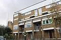
 De Beauvoir Estate (2) - geograph.org.uk - 171434.jpg 640 × 480; 104 KB
-
 De Beauvoir Estate - geograph.org.uk - 129257.jpg 640 × 429; 77 KB
-
 De Beauvoir Estate.jpg 2,816 × 2,112; 1.82 MB
-
 De Beauvoir Road, Islington - geograph.org.uk - 6334848.jpg 1,920 × 1,280; 1.08 MB
-
 De Beauvoir Road, Islington - geograph.org.uk - 6336612.jpg 1,822 × 1,110; 1.04 MB
-
 De-beauvour-new2.jpg 325 × 244; 27 KB
-
 Double Bass player - geograph.org.uk - 6219059.jpg 678 × 1,024; 866 KB
-
 Flats on the De Beauvoir estate, Islington - geograph.org.uk - 6334846.jpg 1,920 × 1,280; 1.12 MB
-
 Flats on the De Beauvoir estate, Islington - geograph.org.uk - 6334849.jpg 1,846 × 1,156; 909 KB
-
 Gainsborough Studios, Hoxton, Shoreditch - geograph.org.uk - 5831095.jpg 1,024 × 768; 252 KB
-
 Grand Canal Apartments - geograph.org.uk - 6219000.jpg 678 × 1,024; 610 KB
-

-
 House of the Hackney Mole Man - geograph.org.uk - 1299259.jpg 640 × 480; 72 KB
-
 Hutley Wharf flats under construction - geograph.org.uk - 5831796.jpg 1,024 × 768; 288 KB
-
 Jesus of Suburbia (277239659).jpg 1,002 × 1,503; 1.07 MB
-
 Kingsland - geograph.org.uk - 5563565.jpg 6,000 × 4,000; 7.31 MB
-
 Kingsland - geograph.org.uk - 5563587.jpg 3,540 × 2,360; 7.62 MB
-
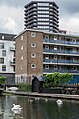
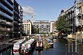
 Kingsland Basin - geograph.org.uk - 6219016.jpg 1,024 × 678; 761 KB
-
 Kingsland Basin, London E8 - geograph.org.uk - 1837380.jpg 500 × 310; 175 KB
-
 Kingsland Basin, Regent's Canal - geograph.org.uk - 5685061.jpg 1,600 × 1,067; 347 KB
-
 Kingsland Basin, Regent's Canal - geograph.org.uk - 5832027.jpg 1,024 × 768; 310 KB
-
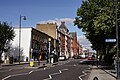
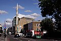
 Kingsland Road, Dalston - geograph.org.uk - 6336506.jpg 1,872 × 1,204; 1.46 MB
-
 Lawford Road, De Beauvoir Town - geograph.org.uk - 4569278.jpg 2,272 × 1,704; 806 KB
-
 Lawford Road, near Hoxton - geograph.org.uk - 5967368.jpg 1,024 × 768; 251 KB
-
 London Skyline From Corbiere House De Beauvoir Estate Hackney - panoramio (1).jpg 3,264 × 2,448; 1.39 MB
-
 London Skyline From Corbiere House De Beauvoir Estate Hackney - panoramio.jpg 3,264 × 2,448; 3.85 MB
-
 Metropolitan Benefit Society Almshouses, Dalston - geograph.org.uk - 6300998.jpg 1,646 × 1,212; 1.13 MB
-
 Moleman House, De Beauvoir Town (2005) (98091571).jpg 640 × 418; 134 KB
-
 N1 street sign.jpg 2,133 × 1,600; 531 KB
-
 New blocks on Southgate Road, Dalston - geograph.org.uk - 6335562.jpg 1,860 × 1,182; 1.19 MB
-
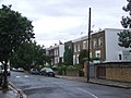
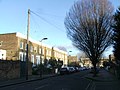
 Northchurch Terrace, near Hoxton - geograph.org.uk - 5967356.jpg 1,024 × 768; 246 KB
-
 Olly Studios - geograph.org.uk - 6219030.jpg 1,024 × 678; 886 KB
-
 Our Lady ^ St Joseph Church, Dalston - geograph.org.uk - 6301000.jpg 1,652 × 1,218; 891 KB
-
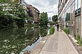
 Regent's Canal - geograph.org.uk - 5564035.jpg 3,780 × 2,520; 7.67 MB
-
 Regent's Canal - geograph.org.uk - 5564039.jpg 3,872 × 2,581; 6.62 MB
-
 Regent's Canal - geograph.org.uk - 5564179.jpg 3,596 × 2,396; 7.69 MB
-
 Regent's Canal - geograph.org.uk - 5564220.jpg 3,660 × 2,440; 7.69 MB
-
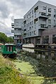
 Regent's Canal - geograph.org.uk - 6218996.jpg 1,024 × 678; 632 KB
-
 Regent's Canal - geograph.org.uk - 6219003.jpg 1,024 × 678; 825 KB
-
 Regent's Canal - geograph.org.uk - 6219012.jpg 678 × 1,024; 768 KB
-
 Regent's Canal - geograph.org.uk - 6219013.jpg 678 × 1,024; 770 KB
-
 Regent's Canal - geograph.org.uk - 6219029.jpg 1,024 × 678; 679 KB
-
 Regent's Canal, De Beauvoir Town - geograph.org.uk - 129262.jpg 640 × 429; 82 KB
-
 Rosemary Branch Bridge - geograph.org.uk - 5831105.jpg 1,024 × 768; 255 KB
-
 Service access off De Beauvoir Road, Islington - geograph.org.uk - 6334842.jpg 1,920 × 1,280; 673 KB
-
 Shoreditch - geograph.org.uk - 5563464.jpg 3,982 × 2,654; 6.77 MB
-
 Shoreditch - geograph.org.uk - 5563468.jpg 5,902 × 3,935; 7.09 MB
-
 Shoreditch - geograph.org.uk - 5563473.jpg 3,909 × 2,605; 6.39 MB
-
 Shoreditch - geograph.org.uk - 5563479.jpg 3,970 × 2,646; 6.66 MB
-
 Stamford Road, De Beauvoir Town - geograph.org.uk - 4569232.jpg 2,272 × 1,704; 758 KB
-
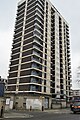
 Tower block on De Beauvoir Road, Islington - geograph.org.uk - 6334856.jpg 1,236 × 1,892; 1.2 MB
-
 Towerblock, De Beauvoir Town - geograph.org.uk - 5385525.jpg 426 × 640; 48 KB
-
 Towerblock, De Beauvoir Town - geograph.org.uk - 5385543.jpg 426 × 640; 77 KB
-
 Ufton Grove, De Beauvoir Town - geograph.org.uk - 4341839.jpg 2,272 × 1,704; 820 KB
-
 Whitmore Bridge, bridge 43, Regent's Canal - geograph.org.uk - 5831814.jpg 1,024 × 768; 391 KB


.jpg)

.jpg)
.jpg)
_-_geograph.org.uk_-_171434.jpg)


.jpg)


.jpg)


_(98091571).jpg)


